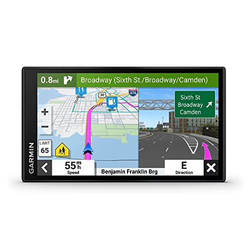
Snowmobiling takes you far past cell coverage, into whiteout conditions where one wrong turn means a long, cold problem. A trail GPS keeps you oriented when landmarks vanish under snow, lets you mark fuel caches and avalanche zones, and gives you a breadcrumb trail back to the truck. The right unit also has to survive subzero temperatures and work with thick gloves, which rules out most phones.
We focused on handhelds and mounts built for cold, wet abuse. We looked at how each one handles glove input, how long the battery lasts in freezing air, the quality of its topographic and trail maps, and whether it offers satellite messaging for true off-grid safety. Here are the seven units worth strapping to your sled.
| Photo | Product | Score | Buy |
|---|---|---|---|
 |
Garmin Montana 700i Best Overall 5-inch glove-friendly touchscreen, inReach satellite messaging, multi-band GNSS |
9.5 |
ⓘ We may earn a commission from qualifying purchases made through links on this page, at no extra cost to you.
|
 |
Garmin GPSMAP 67i Best Battery Life Up to 165-hour battery, inReach satellite, button-operated handheld |
9.3 | 🛒 Check Price |
 |
Garmin Tread Powersport Best Handlebar Mount 5.5-inch all-terrain display, preloaded public land maps, group ride tracking |
9.1 | 🛒 Check Price |
 |
Garmin eTrex 32x Best Value 2.2-inch sunlight-readable screen, preloaded TopoActive maps, AA battery powered |
8.8 | 🛒 Check Price |
 |
Garmin inReach Mini 2 Best for Safety Pocket-sized satellite communicator, TracBack routing, interactive SOS |
8.6 | 🛒 Check Price |
 |
Garmin GPSMAP 65 Best Reception Multi-band multi-GNSS, button control, 16-hour battery |
8.4 | 🛒 Check Price |
 |
Garmin Overlander Best Big Screen 7-inch all-terrain touchscreen, preloaded topo and public land data, on and off-road routing |
8.2 | 🛒 Check Price |
1. Garmin Montana 700i: Best Overall
The Montana 700i is the unit we reach for first because it combines a big, glove-usable touchscreen with built-in inReach satellite communication. When you ride past the last cell tower, this is the difference between a self-rescue and a true emergency. You can send and receive texts, share your live track with family, and trigger an SOS that reaches a global response center, all from the handlebars. The multi-band GNSS holds a lock in tight tree lines and steep canyon walls where lesser units wander.
The honest weakness is its size and the subscription. This is a chunky handheld, and on a vibrating sled it needs a solid AMPS-compatible mount or it feels top-heavy. The satellite messaging and SOS also require an active inReach plan, so the value only makes sense if you actually ride remote terrain. For weekend groomed-trail riders who never lose signal, it’s more capability than you need, but for backcountry it’s unmatched.
- Large 5-inch glove-capable touchscreen readable in bright snow glare
- Built-in inReach satellite two-way messaging and SOS for off-grid emergencies
- Rugged MIL-STD-810 build with multi-band GNSS for canyon and tree-cover accuracy
Pros: Satellite SOS and texting without a phone; Huge screen that gloves can actually operate; Excellent reception under heavy tree canopy
Cons: Large and heavy on a handlebar mount; inReach features need a subscription
2. Garmin GPSMAP 67i: Best Battery Life
The GPSMAP 67i answers the biggest cold-weather GPS complaint: dead batteries. Lithium packs hate subzero air, but this unit is rated for a staggering amount of runtime, enough to cover multi-day expeditions without a recharge. It pairs that endurance with the same inReach satellite messaging and SOS as the Montana, so safety is never compromised. Because it runs on physical buttons rather than a touchscreen, you never have to peel off a glove to mark a waypoint or check your track.
The tradeoff is the interface. Without a touchscreen, scrolling across a map or zooming into a complex trail junction takes more button presses and feels dated next to the Montana. The screen is also smaller, which matters at speed when you want a quick glance. If you prioritize endurance and bulletproof glove operation over slick navigation, this is the smarter pick of the two inReach handhelds.
- Marathon battery rated up to 165 hours in standard mode
- Built-in inReach two-way messaging and interactive SOS
- Physical buttons that work perfectly with the thickest winter gloves
Pros: Battery outlasts the longest multi-day trips; Button control needs no bare fingers in the cold; Reliable satellite SOS coverage
Cons: No touchscreen, so map panning is slower; Smaller screen than the Montana
3. Garmin Tread Powersport: Best Handlebar Mount
The Tread Powersport is the unit to buy if your GPS lives permanently on the handlebars. It’s engineered for the vibration and weather of powersports, with a bright 5.5-inch screen and a rugged mount that shrugs off cold and slush. The preloaded mapping is its standout feature, including topographic detail, public land boundaries, and BirdsEye satellite imagery so you know exactly where you can legally ride. The Group Ride tracking shows your buddies on the map in real time, which is genuinely useful when the group spreads out across a trail system.
This isn’t a unit you tuck in a pocket for a hike, and that’s the point and the limitation. Once it’s mounted it’s committed to the sled, so it does double poorly as a backup handheld. Some of the best group features also depend on additional Garmin radio hardware, which adds to the kit. For a dedicated sled cockpit, though, nothing else is this purpose-built.
- Bright 5.5-inch display purpose-built for handlebar mounting and vibration
- Preloaded BirdsEye and public land boundary maps for backcountry riding
- Group Ride Radio compatibility to track and message your riding crew
Pros: Designed from the ground up for powersports, not repurposed; Excellent preloaded off-road and land-boundary mapping; Tracks your whole group on one screen
Cons: Not a pocket handheld, it lives on the sled; Group features need compatible Garmin accessories
4. Garmin eTrex 32x: Best Value
The eTrex 32x earns its place by being simple, tough, and powered by AA batteries. In deep cold, the ability to pop in fresh lithium AAs that you have kept warm in an inside pocket is a real advantage over sealed rechargeables that fade in the freeze. It comes with routable TopoActive maps, a compass, and a barometric altimeter, giving you the core navigation tools without menus you don’t need. It’s small enough to ride in a chest pocket as a backup to a larger mounted unit.
The compromises are obvious. The 2.2-inch screen is too small to read reliably while you’re moving, so it’s more of a stop-and-check tool than a glance-and-go display. It also has no satellite communication, so it can’t call for help on its own. As a dependable, glove-tolerant, battery-flexible navigator that just works, though, it’s hard to beat for riders who keep things simple.
- Runs on two AA batteries you can swap cold or carry as spares
- Preloaded TopoActive topographic maps with routable trail detail
- Compact, light, and tough with a sunlight-readable color display
Pros: AA batteries mean no dead unit if you carry spares; Genuinely pocketable and lightweight; Solid topo mapping for the simplicity
Cons: Small screen is hard to read at speed; No satellite messaging or SOS
5. Garmin inReach Mini 2: Best for Safety
The inReach Mini 2 isn’t a full navigation screen, and we include it because the single most important job a snowmobile GPS does is keep you alive. This palm-sized communicator gives you two-way satellite texting and an interactive SOS from anywhere with a clear view of the sky, no cell service required. The TracBack function will guide you back along the exact path you came in on, which is exactly what you want in a whiteout. It clips to a chest strap and weighs almost nothing, so there’s no excuse to leave it home.
The honest limitation is that its tiny screen can’t do detailed map navigation. You pair it with the Garmin Explore app on your phone for maps, or run it alongside a dedicated handlebar GPS. Treated as a navigator it disappoints, but treated as a safety net and backup tracker it’s among the most valuable pieces of gear you can carry into the backcountry.
- Ultra-compact satellite messenger that clips to a jacket or pack
- Two-way texting and interactive SOS anywhere with sky view
- TracBack feature retraces your route back to the start
Pros: Tiny and light enough to never leave behind; Global satellite SOS and messaging; Long battery life for its size
Cons: Tiny screen isn’t a real navigation display; Best used alongside a phone or full GPS
6. Garmin GPSMAP 65: Best Reception
The GPSMAP 65 is the receiver to choose when raw positioning accuracy matters most. Its multi-band, multi-GNSS chip locks onto more satellites on more frequencies, so it holds an accurate fix in steep valleys, dense timber, and the kind of terrain where a single-band unit drifts. Like its inReach-equipped sibling, it runs on physical buttons, so checking your position or dropping a waypoint never means removing a glove. You can load custom topographic maps onto it, which serious backcountry riders appreciate.
What you give up versus the 67i is satellite communication, so this unit navigates but can’t call for help on its own. Its battery life is also more ordinary, meaning a long day of constant use may want a recharge or a power bank. If you already carry a separate communicator like the inReach Mini and want the most accurate, glove-friendly map handheld, the 65 is the value-focused choice in the GPSMAP line.
- Multi-band, multi-GNSS receiver for top-tier position accuracy
- Physical buttons for reliable cold and gloved operation
- Expandable storage for loading custom topo and trail maps
Pros: Outstanding satellite reception in difficult terrain; Glove-friendly button interface; Accepts custom and add-on maps
Cons: No built-in satellite messaging; Modest battery compared to the 67i
7. Garmin Overlander: Best Big Screen
The Overlander brings a huge 7-inch touchscreen to the cockpit, and for riders who struggle to read small displays at speed it’s a revelation. The screen is glove-capable and bright, the preloaded mapping includes serious topographic and public land boundary data, and it transitions smoothly from highway navigation on the way to the staging area into off-road trail mode once you unload. If you tow your sled long distances, having one device handle the drive and the ride is genuinely convenient.
The catch is mounting. At 7 inches this is built more for a side-by-side or overland rig than a narrow snowmobile handlebar, so you need to plan a secure place for it. It also lacks built-in satellite messaging, so it’s a navigator rather than a lifeline. For riders with the real estate to mount it and a separate safety communicator, the Overlander delivers the most readable map experience here.
- Massive 7-inch glove-capable touchscreen for easy reading at a glance
- Preloaded topographic maps with public land and trail boundary data
- Smooth on-road to off-road routing for getting to the trailhead and beyond
Pros: Largest, easiest-to-read screen in the lineup; Strong preloaded off-road and topo mapping; Doubles as road navigation to the trailhead
Cons: Too large for many sled handlebars; No satellite SOS messaging
Frequently Asked Questions
Can I just use my phone instead of a dedicated snowmobile GPS?
A phone works on groomed, well-marked trails near towns, but it’s a poor primary navigator for serious snowmobiling. Cell coverage disappears in the backcountry, lithium phone batteries drain fast and shut off in subzero cold, and a touchscreen is nearly useless with thick gloves. Dedicated GPS units are built for freezing temperatures, run on swappable or long-life batteries, work with gloves, and download maps for offline use. The best of them add satellite messaging so you can call for help where a phone shows no bars. Carry your phone as a backup, but don’t rely on it as your only navigation in remote terrain.
Do I really need satellite messaging or is plain GPS enough?
Plain GPS tells you where you’re and how to get back, which covers navigation. It doesn’t let you call for help if you crash, break down, or get caught in an avalanche miles from the road. Satellite messaging, like Garmin inReach, adds two-way texting and an SOS button that reaches a global rescue center from anywhere with sky view, with no cell service needed. If you ride alone, far from roads, or in avalanche country, that capability is worth the subscription. If you only ride busy groomed trails within easy reach of help, a standard GPS may be enough, though many riders still carry a small communicator like the inReach Mini just in case.
How do cold temperatures affect GPS battery life?
Cold is hard on batteries. Lithium-ion cells lose a significant share of their capacity in subzero air, so a unit rated for many hours at room temperature can fade much faster on the trail. To fight this, choose a GPS with a high battery rating like the GPSMAP 67i, or one that takes AA batteries you can swap for fresh ones kept warm in an inside pocket. Keep a USB power bank in a warm layer for recharging rechargeable units. Mounting the GPS where engine heat or your body can take the edge off the chill also helps the battery hold its charge.
Will these GPS units work with thick winter gloves?
It depends on the input type. Button-operated handhelds like the GPSMAP 67i, GPSMAP 65, and eTrex 32x work with any glove because you’re pressing physical buttons. Touchscreen units like the Montana 700i, Tread Powersport, and Overlander use glove-capable screens that respond to thick gloves far better than a phone, though very bulky mittens can still be hit or miss. If glove operation is your top priority, a button-based unit is the safest bet. If you want a big map you can read at a glance, a glove-capable touchscreen is the better experience as long as you test it with your specific gloves.
What maps should a snowmobile GPS have?
Look for topographic maps that show terrain, elevation, and contour lines, since trail signs and landmarks vanish under snow. Public land and trail boundary data is valuable so you know where you’re legally allowed to ride. Satellite imagery, such as Garmin BirdsEye, helps you read terrain features that a basic map misses. Most importantly, all maps must be stored on the device for offline use, because you can’t download anything once cell service is gone. Units like the Tread Powersport and Overlander come with strong preloaded off-road mapping, while handhelds like the eTrex 32x and GPSMAP 65 let you load topo maps and add custom maps yourself.
Our Verdict
For most backcountry riders the Garmin Montana 700i is the top pick, pairing a large glove-friendly touchscreen with built-in inReach satellite messaging and SOS so you get both navigation and a lifeline in one rugged unit. The runner up is the Garmin GPSMAP 67i, which trades the touchscreen for marathon battery life and bulletproof button control, making it the smarter choice for long multi-day trips in deep cold. Whichever you choose, match the unit to how remote you ride and always carry a way to call for help.