When the pavement ends and the cell signal disappears, your phone becomes a paperweight. That’s exactly where a dedicated off road GPS earns its place in your rig. We spent weeks running these units across desert two tracks, muddy forest service roads, and high alpine trails where a wrong turn means hours of backtracking. The goal was simple: figure out which devices actually keep you found when the map app on your phone gives up.
Off road navigation asks more from a GPS than highway driving ever will. You need topographic detail, public land boundaries, preloaded trail databases, and a satellite lock that holds under tree canopy and canyon walls. Below are the seven units that impressed us most, ranked best first, with honest notes on where each one falls short so you can match the right tool to your kind of adventure.
| Photo | Product | Score | Buy |
|---|---|---|---|
 |
Garmin Tread Overland Edition Best Overall 5.5-inch glove-friendly touchscreen, IPX7 rated, preloaded topo and public land maps |
9.5 |
ⓘ We may earn a commission from qualifying purchases made through links on this page, at no extra cost to you.
|
 |
Garmin Montana 700i Best Rugged Handheld 5-inch handheld touchscreen, built-in inReach SOS, multi-band GNSS |
9.3 | 🛒 Check Price |
 |
Garmin GPSMAP 67 Best Battery Life 3-inch sunlight-readable display, up to 180 hours battery, multi-band GNSS |
9.1 | 🛒 Check Price |
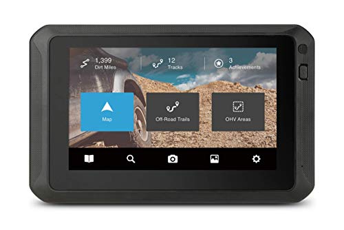 |
Magellan TRX7 CS Pro Best for Trail Database 7-inch waterproof trail tablet, 160,000+ preloaded off road trails |
8.8 | 🛒 Check Price |
|
Garmin Overlander Best On-Road and Off-Road Mix 7-inch rugged touchscreen, on-road and off-road routing in one device |
8.6 | 🛒 Check Price |
 |
Garmin eTrex 32x Best Compact Handheld 2.2-inch display, AA battery powered, preloaded TopoActive maps |
8.4 | 🛒 Check Price |
 |
Garmin Tread Powersport Best for Side by Sides and ATVs 5.5-inch all-terrain display, group ride radio support, vibration rated mount |
8.2 | 🛒 Check Price |
1. Garmin Tread Overland Edition: Best Overall
The Garmin Tread Overland Edition is the unit we kept reaching for when the trail got serious. It’s built from the ground up for off road use rather than adapted from a street navigator, and that shows in the details. The 5.5 inch capacitive touchscreen responds even with muddy gloves, the housing shrugs off dust and a full water dunk thanks to its IPX7 rating, and the preloaded topographic maps include public land boundaries so you always know whether you’re on legal ground. The built in inclinometer with pitch and roll readouts is genuinely useful on off camber climbs.
Where it stumbles is the initial setup. The menu system is deep, and pairing it with the Tread app and an inReach device takes patience before everything talks to each other smoothly. It’s also a physically large device, so cramped cockpits in smaller side by sides may struggle to find a clean mounting spot. Once dialed in, though, nothing else here matches its blend of rugged hardware and overland specific data, which is why it takes our top slot.
- Preloaded topographic maps with public and private land boundary overlays
- Built-in group ride tracking and inReach satellite messaging compatibility
- Pitch and roll inclinometer plus altimeter, barometer, and compass
Pros: Purpose built for overlanding with land management data baked in; Bright sunlight readable display survives dust and water; Tight integration with Garmin inReach for off grid messaging
Cons: Larger footprint needs a solid dash or bar mount; Software has a learning curve before it feels intuitive
2. Garmin Montana 700i: Best Rugged Handheld
The Garmin Montana 700i is the unit to grab when you want navigation and a lifeline in one rugged package. It carries a 5 inch sunlight readable touchscreen that’s among the biggest in the handheld class, and the built in inReach technology means you can send two way texts or trigger an SOS from anywhere with a view of the sky. Multi band GNSS reception kept our position accurate deep in timber and tight canyons where single band units drifted. It clips to a vehicle mount for trail driving and pops off to come with you on foot.
The catch is that the inReach features only work with a paid satellite plan, so the emergency function carries an ongoing commitment beyond the hardware. It’s also a chunky device, noticeably heavier in a pack than a minimalist trail GPS. For overlanders and backcountry hunters who value redundancy and want one device that navigates and communicates, those tradeoffs are easy to accept. This is the handheld we trust most when help could be far away.
- Built-in inReach satellite communicator with two way messaging and SOS
- Multi band GNSS holds a lock under heavy canopy and in canyons
- Military standard durability for shock, water, and temperature
Pros: Doubles as a satellite emergency beacon with no second device; Large handheld screen is easy to read on foot or mounted; Excellent battery life with a removable, rechargeable pack
Cons: Satellite messaging requires an active subscription; Bulky to carry compared to slim trail handhelds
3. Garmin GPSMAP 67: Best Battery Life
The Garmin GPSMAP 67 is the endurance champion of this lineup. With up to 180 hours of runtime on a charge, it’s the unit you bring when you’ll be off grid for days and recharging isn’t an option. The 3 inch transflective display stays readable in direct desert sun, and the multi band, multi GNSS receiver locks on fast and holds position accurately even under canopy. The button driven interface is a deliberate choice that pays off in foul weather, where touchscreens fight you and these tactile keys simply work with heavy gloves.
The compromise is the screen itself. It’s smaller and lower resolution than the touch enabled units here, and map panning with buttons feels slow if you’re used to pinch and zoom. This particular model also lacks built in satellite messaging, so it’s purely a navigator. If your priority is a bombproof, marathon battery handheld that you can trust to outlast your trip, the GPSMAP 67 is hard to beat and well worth its spot near the top.
- Up to 180 hours of battery life in standard mode
- Multi band, multi GNSS support for precise positioning
- Button driven interface works flawlessly with thick gloves
Pros: Outstanding battery endurance for multi day trips; Reliable lock in difficult terrain and tree cover; Physical buttons never miss an input in cold or wet conditions
Cons: Smaller non touch screen feels dated next to touch units; No built in satellite messaging on this model
4. Magellan TRX7 CS Pro: Best for Trail Database
The Magellan TRX7 CS Pro leans hard into one strength: trails, and lots of them. Its built in database covers more than 160,000 off road and OHV routes, which means in most popular wheeling areas you can simply pick a marked trail and follow it without doing your own route planning. The 7 inch waterproof touchscreen is the largest display in this guide, mounted in a rugged cradle that handles trail vibration, and the device records your own tracks so you can share them or retrace them later. For dedicated trail riders, that ready made route library is a real time saver.
The downsides are size and speed. The cradle and large screen eat up a lot of dash space, which can be a problem in tighter cabins, and the software feels a step behind the responsiveness of Garmin’s current units, with occasional lag when loading detailed maps. If your weekends revolve around established off road parks and marked OHV routes, though, the depth of the preloaded trail data here’s unmatched and makes the TRX7 a compelling trail companion.
- Massive built in database of preloaded off road and OHV trails
- Large 7 inch waterproof touchscreen with a rugged mounting cradle
- Records and shares your own tracks with the TRX community
Pros: Enormous trail library covers most established off road areas; Big bright screen is easy to read at a glance while driving; Designed specifically for trucks, Jeeps, and side by sides
Cons: Bulky cradle takes up significant dash real estate; Interface can feel sluggish compared to newer Garmin units
5. Garmin Overlander: Best On-Road and Off-Road Mix
The Garmin Overlander is the do everything navigator for people who drive a long way to reach the dirt. Its standout trick is smooth switching between turn by turn street navigation, complete with traffic and detailed road maps, and off road topographic mode for when the route leaves the grid. It comes preloaded with public land boundaries, campgrounds, and overland points of interest, so planning a multi day route that mixes interstate miles and remote two tracks happens on one screen. The 7 inch rugged touchscreen and onboard pitch and roll gauges round out a genuinely multi-purpose package.
Because it tries to do both jobs, it doesn’t go as deep on either as a specialist. The off road topographic detail is lighter than what you get from a dedicated handheld, and the device, while sturdy, isn’t built to be submerged or dropped the way a true trail handheld is. For overlanders whose trips are half pavement and half dirt, that versatility is exactly the point, and the Overlander handles the transition more gracefully than anything else here.
- Switches between detailed street navigation and off road topo maps
- Preloaded with public land and campground points of interest
- Pitch and roll gauges plus elevation and trip data dashboards
Pros: One device handles highway driving and backcountry trails; Helpful campground and overland POI database built in; Large rugged 7 inch screen reads well in bright light
Cons: Topo trail detail is lighter than dedicated handheld units; Not as durable as fully waterproof handheld GPS devices
6. Garmin eTrex 32x: Best Compact Handheld
The Garmin eTrex 32x is the compact, dependable handheld that belongs in every glovebox as a backup, or as a primary unit for minimalists. Its trump card is power: it runs on two standard AA batteries, so when you run dry deep in the backcountry you swap in fresh cells rather than hunting for a charging port. It ships with TopoActive mapping, a tilt compensated compass, and a barometric altimeter, and despite its tiny size it grabs and holds a satellite fix reliably. Clip it to a pack and it’s barely noticeable on foot.
The tradeoffs come straight from its size and price position. The 2.2 inch screen is small and low resolution, so reading the map while bouncing down a trail takes effort, and the modest processor means panning and zooming feels sluggish next to the bigger units. None of that matters much when you treat it as the rugged, swappable battery backup it’s. As an always works safety net or a featherweight primary for solo hikers, the eTrex 32x delivers real added security.
- Runs on standard AA batteries you can swap anywhere
- Preloaded TopoActive maps with a built in compass and altimeter
- Compact and light enough to clip to a pack or pocket
Pros: AA power means easy field battery swaps with no charging; Small, light, and genuinely pocketable for hiking off the rig; Reliable and proven platform that holds a solid satellite lock
Cons: Small low resolution screen is hard to read at a glance; Slower processor makes map redraws feel laggy
7. Garmin Tread Powersport: Best for Side by Sides and ATVs
The Garmin Tread Powersport is tuned for the side by side and ATV crowd who ride in groups and hammer their gear. Its signature feature is integrated group ride technology: paired with the radio accessory, it lets a whole crew track each other on the map and communicate hands free, which is a genuine standout when you’re spread out across a dusty trail system. The 5.5 inch touchscreen is vibration rated to handle the relentless shaking of an ATV mount, reads well in direct sun, and comes loaded with topographic maps and public land data.
Its weak spot is that the headline group features only reach their potential with the optional radio accessory, so a solo rider pays for capability they may never use. The device is also clearly purpose built for powersports, which makes it less of an all rounder than the Overland edition. But if your idea of a perfect weekend is a convoy of UTVs threading a marked trail network, the group tracking and rugged build here make the Tread Powersport the right call.
- Group ride radio and tracking to keep your riding crew together
- Vibration rated, sunlight readable 5.5 inch touchscreen
- Preloaded topo maps plus public land and trail data
Pros: Group tracking and radio are excellent for riding in a pack; Built to survive the constant vibration of ATVs and UTVs; Glove friendly screen reads clearly in harsh sunlight
Cons: Group radio features need the optional accessory to shine; Overkill for solo riders who don’t ride in groups
Frequently Asked Questions
Do I really need a dedicated GPS for off road, or is my phone enough?
A phone works fine until you lose signal, and off road that happens constantly. Dedicated off road GPS units use multi band satellite receivers that hold a lock under tree canopy and in canyons where phones drift or fail, and they store topographic maps and trail data offline so nothing depends on cell coverage. They’re also built to survive dust, water, vibration, and drops that would kill a phone. For casual day trips on well marked routes a phone with offline maps can suffice, but for remote backcountry travel a dedicated unit is far more reliable and, in a real emergency, far safer.
What is the difference between a handheld and a dash mounted off road GPS?
Handheld units like the Montana 700i, GPSMAP 67, and eTrex 32x are compact, battery powered, and come with you on foot, which matters if you ever leave the vehicle to hike, hunt, or scout. Dash mounted navigators like the Tread Overland, Overlander, and Magellan TRX7 have much larger screens that are easier to read while driving and often include richer trail databases and turn by turn routing. Many serious off roaders carry both: a dash unit for driving and a handheld as a portable backup and emergency communicator. Your choice depends on whether you spend more time in the seat or out of it.
Are topographic maps and public land boundaries preloaded, or do I have to buy them?
Most of the units in this guide ship with topographic maps already installed, and the overland focused models like the Garmin Tread Overland and Overlander also include public and private land boundary overlays out of the box. The Magellan TRX7 goes further with a huge preloaded trail database. Still, some regional maps, premium aerial imagery, or expanded trail layers may be available as separate add ons depending on the brand. Always confirm what is included for your region before relying on a unit, and download any available updates before a trip so your maps reflect current conditions and closures.
Which off road GPS units can send for help when there’s no cell signal?
The Garmin Montana 700i has built in inReach satellite technology, meaning it can send two way text messages and trigger an SOS to emergency services from anywhere with a clear view of the sky, with no phone or cell signal needed. The Tread Overland Edition doesn’t have a satellite radio built in but pairs with a separate Garmin inReach device to add the same capability. The other navigators in this list are purely for finding your way and can’t call for help on their own. If you travel solo or far from help, satellite messaging is the single most important safety feature to prioritize, and it does require an active subscription.
How do I keep my off road GPS from draining or getting damaged on the trail?
For battery, choose a unit matched to your trip length. The GPSMAP 67 runs up to 180 hours, while the AA powered eTrex 32x lets you swap in fresh cells anywhere, and dash mounted units can run off vehicle power through a hardwired or socket mount. For durability, mount dash units in a vibration rated cradle rather than a flimsy phone clamp, since constant trail vibration loosens cheap mounts fast. Look for an IPX7 or better water rating so a creek crossing or rainstorm doesn’t end your trip, and keep the screen clean of dust and mud so the touchscreen stays responsive. A little care here goes a long way.
Our Verdict
After weeks of dirt, dust, and dead ends, the Garmin Tread Overland Edition is our clear top pick for the best GPS for off road. It combines a rugged, water resistant body, a glove friendly screen, and overland specific data like land boundaries and inclinometer readouts into one purpose built package that simply doesn’t flinch on the trail. If you want navigation and an emergency lifeline in a single portable device, the Garmin Montana 700i is the runner up we trust most, thanks to its built in inReach satellite messaging and bombproof handheld build. Match either to your style of adventure and you’ll spend a lot less time wondering where the trail went.
