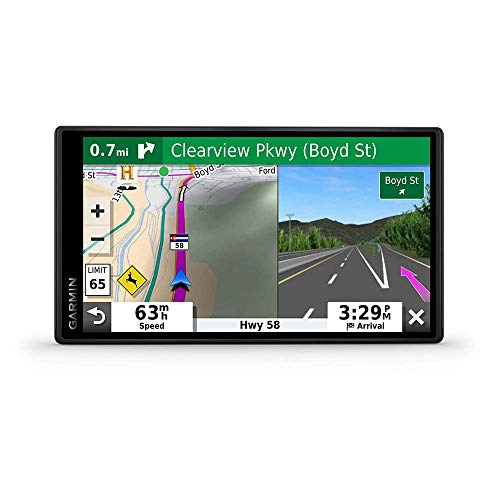
Truck GPS routing happens because commercial trucks have specific size, weight, and cargo restrictions that passenger vehicles don’t. Specialized truck GPS systems use these parameters to calculate routes that avoid low bridges, weight-restricted roads, sharp turns, and other hazards, keeping drivers safe and compliant with local laws.
What Makes Truck GPS Routing Different from Car Routing
Standard car GPS ignores vehicle dimensions and cargo, often routing trucks into dangerous situations. Truck GPS routing accounts for vehicle height (typically up to 13 feet 6 inches), weight (up to 80,000 pounds on interstates), length (often 53-foot trailers), and width (8.5 feet standard). It also considers hazardous materials restrictions, tunnel clearances, and local truck bans. For example, a truck GPS will avoid a road with a 10-foot bridge if the truck is 13 feet tall, while a car GPS would not.
How Truck GPS Routing Works: The Technology Behind It
Truck GPS routing relies on specialized map databases that include over 10 million points of interest for trucks, such as weigh stations, rest areas, and truck stops. The system uses algorithms that factor in real-time traffic, road grades, and even wind conditions for high-profile vehicles. Many units also integrate with ELD (electronic logging device) data to ensure routes comply with hours-of-service regulations. Premium truck GPS devices like those from Garmin or Rand McNally offer custom routing profiles where you can input your exact truck specs, and the device recalculates routes automatically if you deviate.
Common Scenarios Where Truck GPS Routing Is Critical
Truck GPS routing prevents accidents and fines in three key areas: bridge strikes (over 10,000 occur annually in the US costing millions), weight-restricted roads (many local roads have weight limits as low as 10 tons), and low clearance tunnels (like the 12-foot tunnel in Boston). It also helps with navigating narrow urban streets, avoiding residential areas with truck bans, and finding truck-friendly parking. Without it, drivers face ticket costs averaging $500 for bridge strikes and potential liability for damages.
Limitations of Truck GPS Routing You Should Know
No truck GPS is perfect. Map data can be outdated by months, missing new construction or changed restrictions. Over-reliance on GPS can lead to complacency; drivers should always verify routes with physical signs and atlases. Some truck GPS units struggle with complex interchanges or off-grid routes. Additionally, free apps like Google Maps do not offer true truck routing, so investing in a dedicated device or app (like TruckMap or Hammer) is essential. For the best results, combine GPS with a current truckers atlas and local knowledge.
Frequently Asked Questions
Can I use a regular car GPS for my truck?
No, regular car GPS does not consider truck height, weight, or hazmat restrictions, which can lead to dangerous routes, bridge strikes, and fines. Always use a dedicated truck GPS or app.
How often should I update my truck GPS maps?
Update at least every 3 to 6 months, as road restrictions, bridge clearances, and construction zones change frequently. Many premium devices offer lifetime map updates.
What is the best truck GPS app for my phone?
Popular apps include TruckMap, Hammer, and CoPilot Truck. They offer truck-specific routing, but dedicated GPS devices often have better durability and larger screens for professional use. For more GPS options, check our GPS navigation guide.
The Bottom Line
Truck GPS routing is essential for safe, legal, and efficient commercial driving. It prevents costly accidents and fines by tailoring routes to your truck’s specific dimensions and cargo. While no system is flawless, using a dedicated truck GPS with current maps and common sense is the best practice for any professional driver.