When you leave the pavement and head deep into the backcountry, your phone’s mapping app stops being a tool and starts being a liability. Cell signal vanishes, screens overheat in direct sun, and a dead battery can leave you guessing in terrain where guessing is dangerous. A dedicated overlanding GPS solves all of that with preloaded topographic maps, satellite positioning that works with zero cell coverage, and a build that survives dust, vibration, and the occasional drop on rock.
We put the most popular overlanding navigation devices through real trail use, looking at how well they hold a fix under tree cover, how readable the screen stays in glare, how rugged the housing feels, and whether the mapping is actually useful for off-road routes rather than just street turns. Below are the seven units worth your attention, ranked best first, with honest notes on where each one falls short.
| Photo | Product | Score | Buy |
|---|---|---|---|
 |
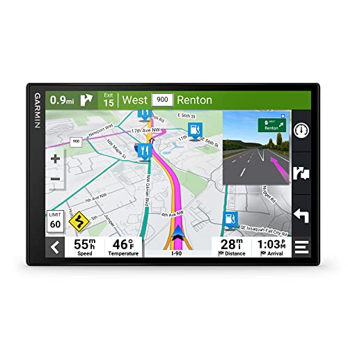
Garmin Tread XL Overland Edition Best Overall 10-inch glove-friendly touchscreen, built-in inReach satellite messaging, preloaded topo and public land maps |
9.5 |
ⓘ We may earn a commission from qualifying purchases made through links on this page, at no extra cost to you.
|
 |
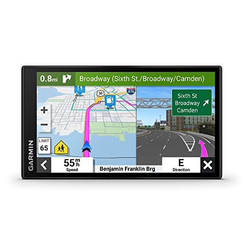
Garmin Tread Base Edition Best Value Off-Road Navigator 5.5-inch rugged off-road display, IPX7 water resistance, preloaded topo and trail maps |
9.2 | 🛒 Check Price |
 |
Garmin Montana 700i Best Rugged Handheld 5-inch glove-touch handheld, built-in inReach, multi-band GNSS, IPX7 rated |
9.0 | 🛒 Check Price |
 |
Garmin GPSMAP 67i Best Battery Life Button-operated handheld, inReach messaging, multi-band GNSS, up to 165-hour battery |
8.8 | 🛒 Check Price |
 |
Garmin Overlander Best All-In-One Road and Trail 7-inch rugged touchscreen, on-road and off-road maps, IPX7 rated |
8.6 | 🛒 Check Price |
 |
Garmin eTrex 32x Best Compact Backup 2.2-inch handheld, preloaded TopoActive maps, barometric altimeter and compass |
8.3 | 🛒 Check Price |
 |
Garmin inReach Mini 2 Best Satellite Safety Companion Palm-sized satellite communicator, two-way messaging, SOS, TracBack routing |
8.0 | 🛒 Check Price |
1. Garmin Tread XL Overland Edition: Best Overall
The Tread XL Overland Edition is the unit we kept reaching for when the route got serious. The 10-inch display is the headline feature, big enough to read a topo line or a trail junction at a glance without squinting, and it stays legible in harsh midday glare where smaller screens wash out. The all-terrain mapping is genuinely built for off-road, with public land boundaries, forest service roads, and BirdsEye satellite imagery layered in so you can see whether that faint two-track actually goes anywhere. The built-in inReach satellite messaging is the part that earns its place in a real expedition kit, letting you text family or trigger an SOS from spots where no other communication exists.
The honest weakness is size and dependency. That gorgeous 10-inch panel eats up dash real estate, and on a compact rig or a tight windshield it can feel like overkill or block sightlines if you mount it carelessly. The satellite features, while excellent, are locked behind an active inReach subscription, so the device is only half as capable until you commit to a plan. If you run a larger truck or full-size 4×4 and you want one device that does everything, this is the one to beat.
- Large 10-inch all-terrain display readable in direct sunlight and with gloves on
- Built-in Garmin inReach two-way satellite messaging and SOS for off-grid emergencies
- Preloaded topographic, BirdsEye satellite imagery, and public land boundary maps
Pros: Best-in-class screen size and brightness for dash navigation; Integrated satellite messaging means no second device to carry; Group Ride Radio and tracking keep a convoy connected off-grid
Cons: Large footprint can dominate a smaller dash or windshield; Satellite messaging features require an active inReach subscription
2. Garmin Tread Base Edition: Best Value Off-Road Navigator
The Tread Base Edition delivers most of what makes the Tread line great in a far more manageable package. The 5.5-inch display is ruggedized and evaluated against shock and vibration, so it shrugs off the constant pounding of washboard roads that would rattle a phone mount loose. You get the same off-road oriented mapping with forest service roads, trailheads, and elevation data, plus a useful set of overland gauges including pitch and roll, an altimeter, and a tripmeter that help you read terrain and track your day. For anyone who wants serious trail navigation without dominating the cockpit, the value here’s hard to argue with.
What you give up is the satellite lifeline. Unlike the Overland editions, the Base has no built-in inReach, so for true off-grid safety you still need to carry a separate messenger. The smaller screen also means you see less of the surrounding map at once, which can matter when you’re trying to plan a reroute around a washout. Still, as a dedicated off-road navigator that punches above its size, it’s an easy recommendation.
- Compact 5.5-inch ruggedized touchscreen rated to military standards for shock and vibration
- Preloaded topographic maps with forest roads, trailheads, and elevation profiles
- Pitch and roll gauges, altimeter, and tripmeter built for off-road awareness
Pros: Fits dashes where the larger Tread units won’t; Strong rugged build with IPX7 water resistance; Off-road gauges add real situational awareness on technical terrain
Cons: No built-in satellite messaging, unlike the Overland editions; Smaller screen shows less map context at a glance
3. Garmin Montana 700i: Best Rugged Handheld
The Montana 700i bridges the gap between a vehicle navigator and a backcountry handheld, and that flexibility is exactly why overlanders love it. The 5-inch glove-friendly touchscreen is large for a handheld and stays readable in bright sun, while the multi-band GNSS locks on quickly and holds a fix in the kind of canyon and tree-cover situations that confuse cheaper receivers. Built-in inReach satellite messaging means you carry your communication and SOS with you when you step out of the truck to scout a line or set up camp, which a dash unit simply can’t do. With a vehicle mount it pulls double duty as your in-cab navigator.
The trade-off is ergonomics behind the wheel. A handheld in a cradle is never quite as clean or as glanceable as a purpose-built dash navigator, and reaching over to tap a small handheld screen while moving is fiddlier than it should be. Battery life is also a watch-it item, since running the display bright all day drains it faster than the spec sheet suggests, so a charging cable in the cab is essential. For people who hike as much as they drive, though, the versatility wins.
- Large 5-inch sunlight-readable touchscreen that works with gloves in the rain
- Built-in inReach two-way satellite messaging and interactive SOS
- Multi-band GNSS for a faster, more reliable fix under tree cover and canyon walls
Pros: Works in the vehicle and on foot, so navigation continues when you leave the rig; Excellent satellite positioning accuracy in difficult terrain; Rugged, water-resistant housing built for genuine abuse
Cons: Handheld form factor is less convenient than a dash-mounted unit while driving; Battery life shortens noticeably with the screen at full brightness
4. Garmin GPSMAP 67i: Best Battery Life
If your trips run long and far from any outlet, the GPSMAP 67i is the unit built for endurance. Its standout figure is battery life rated up to 165 hours, which is the difference between a device that lasts your whole expedition and one you’re constantly nursing on a power bank. The multi-band, multi-GNSS receiver is among the most accurate Garmin makes, holding tight positioning in slot canyons and under heavy tree cover where many units drift. Built-in inReach gives you the same satellite messaging and SOS safety net as the pricier touchscreen handhelds, so you’re never truly out of contact.
The compromise is the interface. This is a button-driven device with no touchscreen, and while the buttons are wonderfully reliable in rain and gloves, panning around a map and entering waypoints is simply slower than tapping a screen. The display is also smaller and non-touch, which makes it a less natural primary navigator on the dash compared to a Tread or Montana. As a rock-solid, long-running positioning and safety device, though, it’s exceptional.
- Exceptional battery life rated up to 165 hours in standard tracking mode
- Built-in inReach satellite communication with two-way messaging and SOS
- Multi-band, multi-GNSS receiver for precise positioning in tough terrain
Pros: Outstanding runtime for multi-day trips far from power; Highly accurate positioning even in deep canyons and forest; Physical buttons work flawlessly with wet or gloved hands
Cons: No touchscreen, so map panning feels slower than touch units; Smaller non-touch display is less ideal as a primary dash navigator
5. Garmin Overlander: Best All-In-One Road and Trail
The Overlander was Garmin’s original dedicated do-everything adventure unit, and it still earns a spot for travelers who want one screen for the whole journey. The 7-inch rugged touchscreen flips cleanly between full street navigation for the long highway haul and topographic off-road mode once you hit dirt, so you aren’t juggling a phone for one and a GPS for the other. The preloaded directory of public campgrounds, RV parks, and points of interest makes trip planning easier than it sounds, and the onboard pitch, roll, and altitude gauges give you a quick read on terrain when things get steep.
Where it shows its age is the software and the lack of integrated messaging. The interface and map data feel a step behind the newer Tread units, with slower menus and an older look, and there’s no built-in inReach, so genuine off-grid safety still means carrying a second device. For overlanders who spend big miles on pavement between trails and want a single capable navigator, it remains a sensible and durable choice.
- 7-inch all-terrain touchscreen that switches between on-road and off-road modes
- Preloaded topographic maps plus Garmin street navigation and public campground data
- Pitch and roll gauges, altimeter, and tripmeter for trail awareness
Pros: Smoothly handles the highway drive to the trailhead and the trail itself; Built-in public land and campground directory is genuinely useful for trip planning; Rugged IPX7 housing tolerates dust and weather
Cons: No built-in satellite messaging, so a separate communicator is still needed; Mapping and software have aged compared to the newer Tread lineup
6. Garmin eTrex 32x: Best Compact Backup
Every overlander should carry a backup, and the eTrex 32x is the one we trust to live in the glovebox. It’s tiny, tough, and runs on two AA batteries, which is the killer feature when you’re days from a charger and can simply swap in fresh cells from your camp kit. Despite the size it carries preloaded TopoActive maps with routable trails and roads, plus a three-axis compass and barometric altimeter that give you reliable heading and elevation even when standing still. Reception is genuinely good for such a small receiver, holding a fix where you might not expect it.
The limitations are exactly what you’d guess from the form factor. The 2.2-inch screen is small and low resolution, so you see very little map context and reading it on the move is a strain. There’s no touchscreen and no satellite messaging, so this is a navigator and nothing more. As a featherweight, battery-flexible safety net that keeps working when your main unit fails, though, it’s brilliant value and worth the glovebox space.
- Pocket-sized rugged handheld that runs on two AA batteries
- Preloaded TopoActive maps with routable roads and trails
- Three-axis compass and barometric altimeter for accurate heading and elevation
Pros: Runs on swappable AA batteries, ideal for remote multi-day use; Light, tough, and dependable as a backup navigator; Strong reception and accurate positioning for its size
Cons: Small low-resolution screen limits map detail at a glance; No touchscreen or satellite messaging
7. Garmin inReach Mini 2: Best Satellite Safety Companion
The inReach Mini 2 isn’t a traditional map-on-a-screen navigator, and that’s exactly why it makes this list. For overlanders who already navigate with a dedicated unit or a phone, this palm-sized communicator adds the one capability the others may lack, which is the ability to call for help from literally anywhere on earth. Two-way satellite messaging and interactive SOS run over the Iridium network with truly global coverage, and the TracBack feature can guide you back along the exact path you came in on, which is invaluable when a route turns into a dead end. Paired with the Garmin Explore app, your phone becomes a capable map while the Mini handles the satellite link.
The honest caveat is that this is a companion, not a complete navigation solution on its own. The tiny screen is for messages and basic data, not for reading topo maps, so without a paired phone it won’t replace a real GPS unit. Like all inReach devices it also needs an active subscription to do its satellite job. As the safety layer that turns any navigation setup into a genuinely expedition-ready one, however, it’s the device we would never leave behind.
- Pocket-sized two-way satellite messaging and interactive SOS via the Iridium network
- TracBack routing helps you retrace your path back to safety
- Pairs with the Garmin Explore app to add full mapping on your phone
Pros: True global satellite coverage for emergencies anywhere; Extremely compact and light, easy to clip on and forget; Long battery life and simple, reliable operation
Cons: Not a standalone map navigator without a paired phone; Satellite messaging requires an active subscription
Frequently Asked Questions
Do I really need a dedicated GPS for overlanding, or is my phone enough?
A phone with offline maps can get you started, but it isn’t enough for serious overlanding. Phones overheat in direct sun on the dash, drain quickly, lose accuracy without cell-assisted positioning, and offer no way to call for help where there’s no signal. A dedicated overlanding GPS uses a rugged sunlight-readable screen, holds a satellite fix with no cell coverage, survives constant vibration and dust, and, on units with built-in inReach, can send an SOS from anywhere. Most experienced overlanders run a dedicated GPS as the primary and keep their phone as a secondary reference rather than the other way around.
What is the difference between a GPS navigator and a satellite messenger?
A GPS navigator shows you maps and your position so you can find and follow routes, while a satellite messenger lets you send and receive messages and trigger an SOS over satellite networks when you have no cell service. Some devices do both, like the Garmin Tread XL Overland Edition and the Montana 700i, which combine full mapping with built-in inReach satellite communication. A unit like the inReach Mini 2 is purely a messenger and needs a paired phone or separate GPS for real navigation. For true off-grid safety you want both functions, whether in one device or two.
Will these GPS units work with no cell signal at all?
Yes, and that’s the whole point. GPS positioning comes from satellites, not cell towers, so a dedicated unit pinpoints your location anywhere with a clear view of the sky, completely independent of cell coverage. The maps are stored on the device itself, so they load without any internet connection. The only feature that needs more than satellites is two-way messaging and SOS, which on inReach-equipped units uses the separate Iridium satellite network and requires an active subscription. Plain navigation and your position on the map work in total dead zones with no signal whatsoever.
Do overlanding GPS devices come with off-road and topographic maps preloaded?
The off-road oriented units on this list do. The Garmin Tread series, Overlander, Montana 700i, GPSMAP 67i, and eTrex 32x all ship with topographic mapping that includes forest service roads, trailheads, public land boundaries, and elevation data rather than just street turns. The Tread XL Overland Edition goes further with BirdsEye satellite imagery layered in. This off-road map content is what separates a true overlanding GPS from a basic road navigator, since it shows you the dirt routes, terrain, and land access that actually matter once you leave the pavement.
How do I mount a GPS for overlanding so it survives rough trails?
Use a solid, vibration-resistant mount rather than a flimsy suction cup. Many overlanders run a dedicated drilled or clamped mount such as a RAM mount that bolts to a secure point, because constant washboard and impacts will shake a cheap mount loose. Position the unit where it’s glanceable but doesn’t block your sightline over the hood or trail, and route the power cable cleanly so it can’t snag. Ruggedized units like the Tread Base Edition and Overlander are built and evaluated for this vibration, but the mount is just as important as the device for surviving genuinely rough terrain.
Our Verdict
For most overlanders the Garmin Tread XL Overland Edition is the clear top pick, combining a huge sunlight-readable screen, genuine off-road and public land mapping, and built-in inReach satellite messaging in one device that does everything an expedition rig needs. If its size or your dash space is a concern, the Garmin Tread Base Edition is our runner up, delivering the same rugged off-road navigation and overland gauges in a far more compact package, with the small trade-off that you’ll want to add a satellite messenger like the inReach Mini 2 for off-grid safety. Match the unit to how you travel, and carry a backup, and you’ll navigate confidently long after the pavement ends.